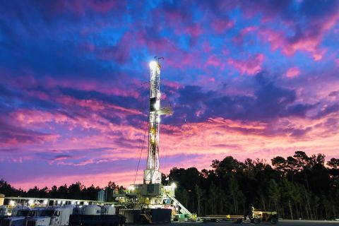
1 Rippey Oil Co., Tyler, Texas, plans to drill the #1 Baker to 10,000 ft. in Jose Maria Mora Survey, A-827, in southeastern Nacogdoches County, Texas, about 10 miles southeast of the city of Nacogdoches. The well offsets a 1970 well that was abandoned in the original borehole and a sidetrack, both below 12,000 ft. The nearest production is a half-mile northwest in the same survey at the only well in Melrose South Field. At that location, the #1 T.W. Baker flowed gas from Travis Peak between 9,062 and 9,342 ft. It produced 597.8 million cu. ft. of gas, 1,411 bbl. of condensate and 5,736 bbl. of water from 1982 through last August, according to IHS Energy. 2 Gas flowing at a rate of 1.3 million cu. ft. a day with 15 bbl. of condensate marked a discovery in north-central Hardin County, Texas, for Sanchez Oil & Gas Corp. A , Houston. The company tested the well on an adjustable choke with 2,020 psi of flowing casing pressure from perforations in Wilcox between 12,011-24 ft. The well is in the Luke Brian Survey, A-76, a half-mile south of Kountz. The nearest producer is the #1 Kirby Library Co., 0.66-mile north-northeast, which has recovered 3.2 million cu. ft. of gas and 88,413 bbl. of condensate since 1952. 3 A wildcat in the greater Houston area in Harris County, Texas, led to a discovery yielding 205 bbl. of oil and 590,000 cu. ft. of gas daily with no water for 1New Century Exploration Inc. IT , Spring, Texas. The #1 Krebs, in John Jones Survey, A-483, was tested through a 14/64-in. choke with 1,250 psi of flowing casing pressure from Yegua between 9,194 and 9,205 ft. Production from a deeper interval at around 9,483 ft. is shut-in and awaiting a pipeline connection. The nearest activity is a mile southeast, where the #1 J.P. Grizzard has produced more than 1 billion cu. ft. of gas, 13,388 bbl. of condensate and 4,948 bbl. of water since 1990, according to IHS Energy. 4 Kerr-McGee Oil & Gas Onshore LLC, Oklahoma City, completed a discovery in the abandoned Fig Ridge Northwest Field area of northwestern Chambers County, Texas, for 5.2 million cu. ft. of gas, 829 bbl. of condensate and no water per day. The company's #9 Janet Macarthy, 3.5 miles southwest of the town of Fig Ridge, produced through a 14/64-in. choke with 6,551 psi of flowing tubing pressure from Discorbis perforations between 10,768-73 ft. The well is in HT&B RR Co. Survey, A-155. Kerr-McGee has asked for a new field designation, although the well is a north offset to a Fig Ridge Field well that produced from Discorbis between 10,162-80 ft. and was later recompleted in shallower Frio. 5 Rio-Tex Inc., San Antonio, has a wildcat campaign in the works in southern Texas, with exploratory tests in Kerr and Zavala counties, according to IHS Energy. In northwestern Kerr County, the company plans a remote 9,000-ft. test where only one commercial producer has emerged in 108 tests. The company's #1 Klein is 35 miles southwest of Kerrville in Section 25, John H. Gibson Survey, A-165. The only well to produce in the county is six miles west-northwest. In Zavala County, the company has staked the #1 Picosa Creek in undrilled Section 319, Mrs. Martha A. Campbell Survey, A-1219. The 9,000-ft. test is about 10 miles west of Crystal City. The nearest production from a similar depth is four miles northwest in Pilosa Field. 6 Oklahoma City-based Chesapeake Operating Inc. has completed a wildcat discovery with its #1 Cis in James L. Mills Survey, A-200, in northern Goliad County, Texas, about 13 miles northeast of Goliad. The 9,800-ft. discovery flowed 1.5 million cu. ft. of gas, 15 bbl. of condensate and four bbl. of water daily through a 12/64-in. choke with 1,815 psi of flowing tubing pressure from perforations in an unreported zone between 5,237-46 ft. The nearest production was from abandoned West Creek Field a half-mile south-southwest. 7 C&E Operating Inc., Sugar Land, Texas, plans to drill the 11,000-ft. #1 Foester in Narcisco Cabazos Survey, A-3, in Calhoun County, Texas, about four miles south-southeast of Port Lavaca. The nearest well is about a quarter-mile south-southwest at the abandoned #1 Curtis Foester. 8 ExxonMobil Corp. continued its chain of South Texas exploration successes with the #48 King Ranch Canelo wildcat, which flowed 8.8 million cu. ft. of gas, 77 bbl. of condensate and seven bbl. of water a day from Frio perforations between 8,858-91 ft. The well is in Charlotte Breeding Survey, A-20, in southwestern Kleberg County, Texas. Tests were run through a 22/64-in. choke with 3,373 psi of flowing tubing pressure. This well is about a mile northwest of the #1 King Ranch State discovery, completed by the company in October for 6 million cu. ft. of gas a day. 9 The Vicksburg formation between 15,924 and 17,246 ft. produced a discovery flowing 3.7 million cu. ft. of gas and 124 bbl. of condensate daily with no water for El Paso Production Oil & Gas Co., Houston. The 18,915-ft. #1 Maguire Oil Deep is in Jose Antonio Leal de Leon Survey, A-61, about 14 miles southwest of Sarita in northwestern Kenedy County, Texas. El Paso is drilling the #2 well a mile southeast in the same survey. 10 LLOG Exploration Texas LP, Metairie, La., tested a discovery on Matagorda Island Block 834S, offshore Aransas County in Texas state waters in the Gulf of Mexico, for 10.3 million cu. ft. of gas and 187 bbl. of condensate daily. The company perforated the well between 9,573 and 9,612 ft. in an unreported zone and measured 5,668 psi of flowing tubing pressure in the 10,296-ft. well. The producer offsets the only previous well on the block, a 1979 well that produced 430,752 bbl. of oil and 293.5 million cu. ft. of gas with 56,616 bbl. of water from Miocene between 6,433-48 ft. between 1981 and 1988. 11 Houston-based ATP Oil & Gas Corp. has started production from its #A-1 OCS-G-21378 offshore Matia prospect well on Garden Banks 142 in the Gulf of Mexico at a rate of 15 million cu. ft. of gas a day. The company drilled the well in 80 ft. of water to a total depth of 4,844 ft. to find 80 ft. of net gas pay in Pleistocene trimosina A. The company is drilling the #A-2, the Cabrito prospect well, from the same location toward a bottomhole point in Block 186, immediately south. 12 A deepwater well permitted by W&T Offshore Inc., Metairie, La., will search a prime piece of the Gulf of Mexico with a wildcat stalking 1BP wà 's Holstein. The #1 OCS-G-20083 is in 4,230 ft. of water in Green Canyon 646, two blocks east of BP's Holstein discovery and a block northwest of the Dominion Exploration & Production Inc. Poseidon well. The nearest production comes from King Kong Field more than 10 miles northeast. That field flows gas from Pliocene, according to IHS Energy. 13 Geomet Operating Co. Inc., Birmingham, Ala., is drilling ahead at the #3 Weyerhaeuser wildcat in east-central Winn Parish, La. The well, in Section 10-11n-1w, is one in a series of wells planned by the company. More than five miles west, the #1 well has been cased, and casing has also been run on the #2 well, 0.33-mile east-northeast of the #3, to its total depth of 3,235 ft. No activity has been reported at the sites for the #4, #5 and #6 wells. The nearest production to the #3 well is 1.33 miles southwest in Colgrade Field, which produces from Wilcox from 1,320-24 ft. 14 1Penn Virginia Oil & Gas Corp., Radnor, Pa., plans to drill a 7,200-ft. remote wildcat in northeastern Livingston Parish, La. The company's #1 Weyerhaeuser Co. will look for gas in Planulina in undrilled Section 26-5s-4e. An abandoned well was drilled 1.25 miles west-northwest and the nearest production is four miles south-southwest in Bills Branch Field. 15 A southwestern Mississippi wildcat is in the works within two miles east, west and south of the Louisiana border formed by a loop in the Mississippi River. 1Belle Exploration Inc., H Natchez, Miss., is drilling the 6,800-ft. #1 Hogue Estate "GT" in irregular Section 25-5n-42 in southwestern Adams County. The nearest production is about 1.5 miles east-southeast in Briars Chute South Field, where the #5 Hogue Estate "A" has produced 58,696 bbl. of oil, 11.8 million cu. ft. of casinghead gas and 1.2 million bbl. of water from Campbell sand between 5,387 ft. and 6,390 ft. since 1992. 16 Wilkinson County, Miss., is hosting several wildcats. Among shallower wells, 1Threshold Development Co. Q3 , Fort Worth, plans two tests to 4,000 ft. in the northeastern part of the county, just west of the Amite County boundary. The company's #1 Crosby-Ware 12-F is in Section 12-3n-1e, about 0.33-mile northeast of the nearest drilling in Section 11. The second wildcat is the #1 Ware 1-F, about 1.25 miles north of the Crosby-Ware well in the same section. The company drilled the #1 Ware 2-F about 0.33-mile west-southwest of the 1-F well in February 2002, but no activity has been reported at that site. In the southwestern corner of the county, Patterson Petroleum LP, Snyder, Texas, will drill its #1 L.T. Christian to 14,200 ft. The wildcat is just north of the Louisiana border in Section 38-1n-32. The nearest drilling to that well is 0.75-mile south in West Feliciana Parish, La..
Recommended Reading
Post Oak-backed Quantent Closes Haynesville Deal in North Louisiana
2024-09-09 - Quantent Energy Partners’ initial Haynesville Shale acquisition comes as Post Oak Energy Capital closes an equity commitment for the E&P.
Private Producers Find Dry Powder to Reload
2024-09-04 - An E&P consolidation trend took out many of the biggest private producers inside of two years, but banks, private equity and other lenders are ready to fund a new crop of self-starters in oil and gas.

Companies Take Advantage of ABSs to Finance Acquisitions
2024-10-17 - Some companies have taken advantage of asset-backed securitizations to monetize some of their cash flows and better position themselves for a sale.

Private Equity Gears Up for Big Opportunities
2024-10-04 - The private equity sector is having a moment in the upstream space.

Post Oak Backs New Permian Team, But PE Faces Uphill Fundraising Battle
2024-10-11 - As private equity begins the process of recycling inventory, likely to be divested from large-scale mergers, executives acknowledged that raising funds has become increasingly difficult.
Comments
Add new comment
This conversation is moderated according to Hart Energy community rules. Please read the rules before joining the discussion. If you’re experiencing any technical problems, please contact our customer care team.