2 Aspen Exploration Corp., Bakersfield, Calif., plans a 7,800-ft. wildcat in Kern County, Calif. Aspen will drill #63X-28 in Section 28-28s-26e in search of oil and gas. The site is 5.1 miles north of Rosedale. Nearest production is in Rosedale Ranch Field, which produces from Etchegoin sand, 1.7 miles northwest.
3 Two wildcats have been scheduled in northeastern Nevada, reports IHS Inc. The first is a 12,000-ft. probe staked by Trail Mountain Inc., an affiliate of Yates Petroleum Corp., Artesia, N.M., approximately 12 miles south-southwest of Carlin in northeastern Eureka County. The #1 Palisades is in Section 27-31n-51e, five miles west-northwest of the inactive Tomera Ranch Field and about 20 miles from the nearest production in Pine Valley's Blackburn Field. The second wildcat, planned by V.F. Neuhaus Properties Inc., McAllen, Texas, is in Section 17-28n-56e in southwestern Elko County. The #17-1 Straight Flush will be drilled to a depth of 7,000 ft. about 24 miles east-northeast of Blackburn Field and 35 miles south of Elko. Double Eagle Petroleum Co., Casper, Wyo., is a partner in the Straight Flush well, and owns more than 182,000 net acres in Huntington Valley.
4 Delta Petroleum Corp., Denver, Colo., plans a remote Utah Hingeline wildcat about nine miles northwest of Parowan in southwestern Utah's Iron County. The #23-34 Federal is in Section 23-33s-10w, and will target Kaibab in the Permian at 15,500 ft. The site is in an undrilled township approximately 84 miles southwest of Sevier County's Covenant Field, where oil reserves in Jurassic Navajo are currently under development.
5 Targe Energy Exploration & Production LLC, a unit of Pittsburgh-based Targe Energy LLC, plans a three-well exploratory program in the Rocky Mountain region on the Sweetgrass Arch in northwestern Montana, 13 to 17 miles southeast of Sunburst. Targe applied for drilling permits for #16-16 State in Section 16-35n-1e, #13-17 Grinde in Section 17-35n-1e and #12-26 Turner in Section 26-35n-1e. The wells will be in eastern Toole County and will range in depth from 2,200 to 3,400 ft. Nisku and Madison are primary objectives. The nearest Nisku production is about two miles east-southeast in Ninemile Field.
6 Kodiak Oil & Gas (USA) Inc., Denver, Colo., made an oil discovery in northeastern Montana when a drilltem test recovered oil from Mission Canyon (Madison) some 11 miles east-southeast of Plentywood. The #11-7 Salvation Army is in Section 7-34n-57e in eastern Sheridan County. The test reversed out a highly cut gas-and-oil mud emulsion from Mission Canyon at 7,512-72 ft. The sample contained 1,700 cc of 33.9-gravity oil and 1 cu. ft. of gas at 430 psi. Nearest production is a mile southwest, where oil is produced from Red River.
7 EOG Resources Inc., Houston, staked a horizontal wildcat targeting Bakken in a nonproducing township some 10 miles south of Palermo in east-central Mountrail County, N.D. The #1-02H Austin is in Section 2-154n-90w, and is anticipated to encounter Middle Bakken at a true vertical depth of about 9,221 ft. The site is five miles southeast of Madison oil production in Stanley Field. Parshall Field is about nine miles south.
8 Several horizontal Bakken exploratory tests are slated for Dunn County, N.D. Marathon Oil Co., Houston, will drill #11-18H Buehner in Section 18-146n-93w, some eight miles north-northeast of Dunn Center and 1.5 miles east of Bailey Field. It also staked #34-32H Darcy in Section 32-146n-93w. About 12 miles west, Continental Resources, Enid, Okla., has scheduled #1-18H Pletan in Section 18-146n-95w, eight miles northwest of Killdeer. The nearest Bakken discovery is 1.5 miles northeast. Denver-based Ansbro Petroleum Co. LLC will drill a horizontal Bakken wildcat in southwestern Dunn County about 15 miles north-northwest of Dickinson. The #1-23 Charlie is in Section 23-142n-97w, 1.5 miles northwest of Russian Creek Field, which produces from Madison and has a gas pay in Red River, according to IHS Inc.
9 Ballard Petroleum Holdings Inc., Billings, Mont., staked a wildcat 12 miles north of Oshoto, Wyo., in eastern Powder River Basin. It will drill #24-13 Wenande-State to a depth of 6,100 ft. to evaluate Minnelusa. The well is in tract 47 in Section 13-55n-68w in northwestern Crook County. Nearest production is two miles southeast in Carr Creek Field in Section 25-55n-67.5w. Corral Creek Field, a two-well Minnelusa pool, is over two miles south-southwest.
10 GMT Exploration Co. LLC, Denver, Colo., plans two 9,000-ft. wildcats in southern Wyoming near the Great Divide Basin, some 19 miles southeast of Wamsutter. It will drill #24-3 SJ-Fee and #13-3 SJ Fee in Section 3-18n-91w, about 0.5 mile apart, and will evaluate Mesaverde gas zones, including Rock Springs. The wildcats are over two miles east of an inactive well in the Creston Field area.
11 Central Operating Inc., Denver, Colo., will drill the 6,100-ft. #1 Carlson to target the D and J sands in the northeastern flank of the Denver Julesburg Basin, about 17 miles north-northeast of Kimball in western Nebraska. The well is in Section 5-17n-54w in southeastern Banner County, more than 1.5 miles northeast of the inactive discovery for Flint Field, completed in 1967. Two-well Unos Field, also inactive, is about two miles east-northeast.
12 Evertson Operating Co., Kimball, Neb., staked a wildcat in northeastern Denver Julesburg Basin 12 miles northeast of Sidney, Neb. It will drill #44-32 Wittrock in Section 32-15n-47w in eastern Cheyenne County. The 4,500-ft. test will target D and J sands. Nearest previous production is in Franzen Field, an inactive 10-well pool three miles northwest. Abandoned Sunol Field is some four miles west-southwest.
13 Retamco Operating Inc., Roberts, Mont., plans a third Piceance Basin-wildcat some 15 miles east of Rangely, Colo. The #3-12 North Barcus Creek-Federal is in Section 12-1n-99w in western Rio Blanco County. It will evaluate Mesaverde gas zones to a depth of 10,965 ft. The proposed site is about five miles northwest of Yellow Creek where a multi-zone Mesaverde discovery was completed last year flowing at a combined rate of 1.29 million cu. ft. of gas and 654 bbl. of water a day. It is within 0.5 mile of two previous Mesaverde tests drilled by Retamco.
14 Cabot Oil & Gas Corp., Charleston, W.Va., plans a 9,000-ft. wildcat in the eastern flank of the Paradox Basin in southwestern Colorado, some 17 miles southwest Naturita. It will drill #31-30 South Gypsum in Section 30-44n-17w in western San Miguel County to evaluate Mississippian Leadville. Slick Rock Field is 3.5 miles southeast, and the nearest Leadville discovery is four miles west-northwest.
15 Navajo Nation Oil & Gas Inc., Window Rock, Ariz., plans the first of two wildcats on the Navajo Indian Reservation 11 to 13 miles northwest of Shiprock in northwestern San Juan County, N.M. It plans to drill #36 E. Atse in Section 36-32n-20w to a projected depth of 7,200 ft. to evaluate Pennsylvanian Paradox oil zones and Mississippian Leadville gas potential. It also plans to drill a 7,200-ft. Paradox/Leadville test at #1 Falcon 6-1 in Section 6-31n-19w, two miles southeast. Both projects are four to six miles east-southeast of abandoned Four Corners Field, reports IHS Inc.
16 Westerly Exploration Inc., Houston, completed a northwestern New Mexico wildcat as a discovery on the southeastern flank of the San Juan Basin some 10 miles north of Cuba. It drilled #34 Romero-Federal in Section 34-23n-1w in northwestern Sandoval County. That well initially pumped 24 bbl. of oil a day from a fractured Gallup interval perforated between 6,551 and 6,798 ft. The discovery is two miles east-southeast of Pictured Cliffs gas production in Blanco South Field. The nearest Gallup discovery is 3.5 miles north in Section 15-23n-1w in Rio Arriba County.
Recommended Reading

Analyst: Is Jerry Jones Making a Run to Take Comstock Private?
2024-09-20 - After buying more than 13.4 million Comstock shares in August, analysts wonder if Dallas Cowboys owner Jerry Jones might split the tackles and run downhill toward a go-private buyout of the Haynesville Shale gas producer.
BKV Prices IPO at $270MM Nearly Two Years After First Filing
2024-09-25 - BKV Corp. priced its common shares at $18 each after and will begin trading on Sept. 26, about two years after the Denver company first filed for an IPO.

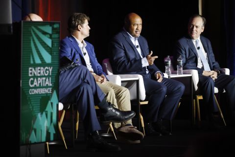
Sheffield: E&Ps’ Capital Starvation Not All Bad, But M&A Needs Work
2024-10-04 - Bryan Sheffield, managing partner of Formentera Partners and founder of Parsley Energy, discussed E&P capital, M&A barriers and how longer laterals could spur a “growth mode” at Hart Energy’s Energy Capital Conference.
Post Oak Backs New Permian Team, But PE Faces Uphill Fundraising Battle
2024-10-11 - As private equity begins the process of recycling inventory, likely to be divested from large-scale mergers, executives acknowledged that raising funds has become increasingly difficult.

Investor Returns Keep Aethon IPO-ready
2024-10-08 - Haynesville producer Aethon Energy is focused on investor returns, additional bolt-on acquisitions and mainly staying “IPO ready,” the company’s Senior Vice President of Finance said Oct. 3 at Hart Energy’s Energy Capital Conference (ECC) in Dallas.
Comments
Add new comment
This conversation is moderated according to Hart Energy community rules. Please read the rules before joining the discussion. If you’re experiencing any technical problems, please contact our customer care team.