
The collected data was used to bias-correct TGS’ Numerical Weather Prediction (NWP) model simulations. (Source: Shutterstock)
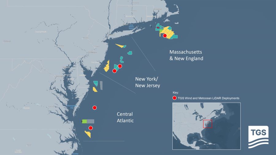
TGS has completed a two-year mega-regional wind and metocean data collection campaign along the U.S. East Coast—the largest of its kind in the region.
The campaign involved deploying and operating five offshore LiDAR buoys covering 600 km from Massachusetts to the Virginia-North Carolina border. The buoys collected a range of wind and metocean data, including wind speed and direction, wave heights and ocean current data across the full water column.
“These unique measurements empower developers to accurately assess the true wind resource variability across most of the U.S. East Coast offshore wind lease areas,” Carel Hooijkaas, executive vice president of new energy solutions at TGS, said in the July 24 press release.
The collected data was used to bias-correct TGS’ Numerical Weather Prediction (NWP) model simulations, making it the most validated high-resolution wind resource dataset along the U.S. East Coast.
TGS said that both the quality-controlled measurement data and the NWP model data are being utilized by developers to inform and refine their bidding strategies for BOEM’s upcoming Central Atlantic offshore wind lease auction.
Similar initiatives have been successfully deployed in Germany and offshore Norway, with additional campaigns planned globally.
Recommended Reading
US NatGas Prices Hit 23-Month High on Increased LNG Feedgas, Heating Demand
2024-12-24 - U.S. natural gas futures hit a 23-month high on Dec. 24 in thin pre-holiday trading.
Analysts: How Trump's Tariffs Might Affect Commodity, Energy Sectors
2025-02-03 - Trump's move has sparked volatility in the commodities market. Oil prices rose, with WTI up 2.4% at $74.27 a barrel and Brent crude futures adding 1% to $76.40 a barrel.

EIA: Gulf Production Suffered from Eventful Hurricane Season
2024-12-17 - Oil and gas platforms under-produced in September and November, the Energy Information Administration reported.

NatGas Rally Reaches 2024 Peak, Highest Price in Two Years
2024-12-19 - Analysts say the gas market remains volatile as prices surpass $3.50/MMbtu at the Henry Hub for the first time in about two years.
Comments
Add new comment
This conversation is moderated according to Hart Energy community rules. Please read the rules before joining the discussion. If you’re experiencing any technical problems, please contact our customer care team.